Print Story
X

It’s a long and treacherous trek to Rash Phari but the stunning panoramic views from the top make it a truly memorable experience
For us city slickers there is only so much one can take of daily mundanities as they wear one down - both mentally and physically. One must attempt to escape the vagaries of everyday life, if only for a short while -- and that is exactly what I attempted to do when I, along with a dear friend, trekked to Rash Phari this summer.
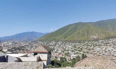
Hidden in the lap of some of the highest mountains in the world, at about 4,700m above sea-level, lies Rash Phari (translated from the local Burushaski as ‘Sparkling Lake’). Located in a remote region in Hopar Valley in Nagar, Rash Phari is still very much off the beaten track, even though many trekking agencies lead several groups to the location each year. It has been more popular with foreign tourists than locals for quite some time.
We started our journey from Lahore, from where Hunza is a long way by road (about 100km from Gilgit), unless you are okay flying to Gilgit -- and burning a giant hole in your pocket. We took the long and arduous journey by road, and the only thing that needs be said is that the Karakoram Highway is in dire need of maintenance in many parts, and our journey was punctuated by numerous traffic jams, as it was just after Eidul Fitr.
Upon reaching Karimabad in the picturesque Hunza Valley, we made the voluntary decision to give ourselves a day or two to get acclimatised to the high altitude, so we did the short walks to the Baltit and Altit forts from Karimabad and walked up to Duikar, something, we were told admiringly by locals, blokes from Punjab are usually loath to do. We then hired a guide from Karimabad, Abdul Karim, who was a rather colourful character, and who arranged porters to meet us at Hopar Village, the starting point of our trek.
The quaint village of Hopar is connected to Karimabad by a metaled road and rests at an altitude of 2800m, right on the edge of the Hopar glacier, which in recent years has become a popular tourist spot in itself. The World Wildlife Fund (WWF) designates areas beyond Hopar as protected zones for markhor and snow leopard species. We were fortunate enough to spot snow leopard tracks along our trek.
The first obstacle as we started our trek was crossing Hopar Glacier, that in the 1990s was tearing along at a reckless 20m per day, and forcing itself into mammoth needle-like ice pillars and gaping crevasses. It can either be a relatively easy trudge or if there is rain, a tricky hour or so carefully maneuvering slippery ice and evading bottomless crevasses. Thankfully for us, it was the former, though much harder on our return.
After crossing Hopar Glacier we came to the flat Shishkin meadows, after which we made the much easier crossing of the Barpu glacier, the noisy outflow of which falls directly into the Nagar River below. A two-hour trudge across plains dominated by thorny bushes and rockfall from adjacent mountains led us to our campsite at Beri Chokor at 3200m, located on the moraine of the sparkling-white Miar Glacier.
The campsite offered excellent views of Spantik or Golden Peak (7027m) to our east and the peaks of Hunza Valley to the west. The stillness and calm here was only broken by a glacial stream running right through the campsite and the warning calls of the Raam Chokor (a species of partridge that is also Pakistan’s national bird). As the weather was surprisingly cold and damp for June, we spent our evening cosying up to a fire, and were treated to a fine meal by our guide (who also doubled as our cook), as well as some remarkable stories told by him and our porters.
The next day was cold and damp as well, and we had to make the steep ascent up a rocky path to our campsite at Gutens, which at 4000m was something straight out of a Thomas Cole painting.
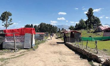
Gutens is a lush green pasture used by the people of Hopar in summers, where they tend to sheep, goats and cattle. When we got there in the afternoon, the weather had momentarily cleared, and the biting wind was neutered by the warm sunlight, affording stunning views in all directions: to the northwest was Hunza Valley and its associated peaks, Ladyfinger, Ultar Sar and Ultar Peak; to the north and northeast were the barren Hispar Gorge and Hispar Range, with the Lupghar, Momhil, Trivor, Bularung and Kunyang peaks all visible, all over 7000m.
Behind us was the steep ascent we would have to scale the next day, to the pastures at Chidin Harai, and then further up to Rash Phari. Unfortunately, a storm raged that night, with wind and rain splashing against our tent. The sight that greeted us after we got out of our camp the next day was ominous: Hispar Range across the gorge was covered in snow, and so were the upper reaches of our projected path. Our guide, Abdul Karim, was not too hopeful of our chances (and abilities) but having come this far, we were in no mood to give up easily. We urged him on, and after having a few morsels of toast and jam for breakfast, we set off.
Sure enough, as we gained altitude, the snow from last night began to make its presence felt. It was hard enough gaining altitude at this point and the snow made it doubly difficult. The rocks were slippery, and the snow began to get deeper, so it was impossible to see where and what we were stepping on. A slip or a fall could be disastrous. It is to the credit of Abdul Karim, who led us expertly, that we fared well. As we neared the lake, snow began to fall, and was almost ankle deep; the path remained steeper than ever.
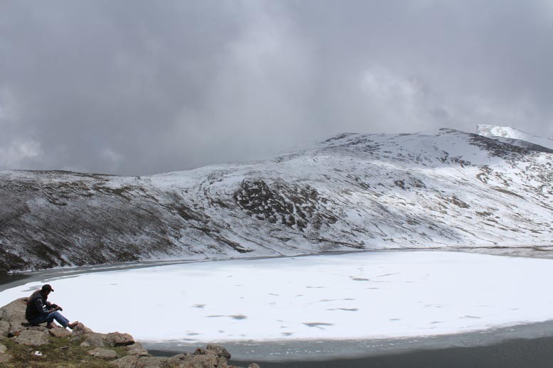
A couple of hours later, when our path finally straightened, the sun came out as well, and for the last two to three hundred metres we were completely snow-blind. I remember trudging along blindly in the snow, until we finally came across Rash Phari, half-frozen, half obscured by clouds. The site truly lived up to its name though: Rash Phari - sparkling waters. It sparkled as the sun shone on its waters, and the clouds suddenly parted.
For the next few hours sadly, we couldn’t camp at the lake, we stood in awe of the lake and its surroundings. From the lake, on a clear day, one has a panoramic view of all the aforementioned seven-thousander peaks, including the stunning Spantik (Golden Peak, 7027m).
If one is able to take an extra day exploring the lake, and if weather conditions permit, one can make the short hike up to Rash Peak (5098m) and see the barren Hispar Pass (5128m) in the distance. Some say K2, the second highest peak in the world, at 8611m, is also visible from Rash Peak, although the claim is contested by others.
While we would have loved to camp the night and hope for the skies to clear up so that we could attempt Rash Peak (5098m), the weather was so turbulent that we could only spend a few hours at the lake, before turning back. The trek to Rash Lake was indeed the adventure of a lifetime.
Also, being in that part of the world also gave us a unique window into the lives of some of the most resilient, welcoming and disenfranchised people of our country. Their beautiful culture, language and way of life today face extinction, as a result of emigration, higher education in other major cities, and complete neglect by the Pakistani state.
It was also staggeringly obvious to us on our trip the impact climate change is having on our fragile environment. The weather in Hunza, Hopar and adjoining areas was surprisingly damp and cold for mid-to end-June. The lake, to the knowledge of our porters, had never had this much snow in June. In fact, by this time of the year, it is usually covered in lush green grass and there is not a cloud in sight. Late snow means late melt and if there is more rain than usual, greater chances of flooding, coupled with the faster rate of melting glaciers due to rising overall temperatures.
And so it happened, just a few days after our departure, flooding and land erosion damaged the road leading to Hispar and submerged a part of it, cutting it off from the rest of the world.
A collective, conscious effort must be launched to preserve this precarious balance between flora and fauna that has coexisted for millennia and is facing its biggest existential threat yet.
The writer is an avid trekker. He tweets @bandaydaputtar.