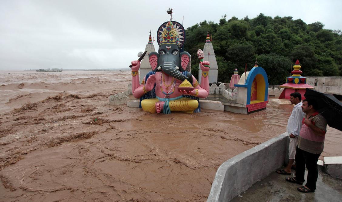
The country has been taking both structural and non-structural measures to control floods

South Asia has seen many natural disasters and human tragedies. Population bulge, poverty, climate change, and poor governance are major contributing factors that exacerbate impact of natural disasters in this region.
According to a report of the Asian Development Bank, Asia has braced more than 1200 disasters during the last 100 years.
South Asia, particularly, has faced most of these disasters. Monsoon in the southwest region in summer and monsoon in the northwest in winter often unleash devastating floods in the region.
Floods affect millions of people every year. India also faces frequent wrath of these floods. Uttar Pradesh, Uttarakhand, Bihar, Punjab, Assam, West Bengal, Orissa, Madhya Pradesh, and Tamil Nadu are some of the flood-prone states. Over 8 per cent of Indian area (approx. 40 million hectares) is prone to floods. Of the nearly 7,500 kilometres long coastline, approximately 5,700 kilometres is prone to cyclones.
Almost a quarter of the Indian population lives within 50 km of the coastal line. These areas and communities are vulnerable to cyclones and ensuing rain-floods. On an average, annually, 1,588 lives are lost and 7.5 million hectares of land is affected due to the floods.
Between 1953 and 2005 abrasive floods took 84,207 lives in India. The flood damages reported from 1953 to 2010 amount to a staggering Rs8,125 billion.
India has been taking both structural and non-structural measures to reduce disaster risk. According to the Indian constitution, the primary responsibility for flood control lies with the states. A number of states have enacted relevant laws and have developed localised flood management plans.
Under the Disaster Management Act, 2005 each district is supposed to have a disaster management plan and a district disaster management committee. Each state has a disaster management cell.
Major funding for the cell comes from the central government. Each cell is supposed to carry training in disaster management and prepare plans and documents. The National Disaster Management Authority, created in 2005 is responsible and authorised for overall policy framework and implementation of the policies and plans for disaster management along with management of funds for various initiatives.
Under structural measures, India has undertaken construction of reservoirs, detention basins, embankments, river channels, flood water diversion, and watershed management. It is generally believed that dams can prevent floods and reduce intensity of disasters.
After the US and China, India has the highest number of dams, yet disasters refuse to go away. Jawaharlal Nehru, India’s first prime minister encouraged dam construction as a symbol of modernisation and industrial development. India has constructed a total of 5,125 large dams and another 397 large dams were under construction till 2011.
These are multi-purpose dams and flood mitigation is only one of the objectives. However, some of the recent disasters have broken the myth and actually revealed that dams were the major cause of multiplying the impact of disaster.
There are numerous incidents of disasters triggered by dams in India. Panshet Dam, also called Tanajisagar Dam was constructed in late 1950s on the Ambi River, located about 50 km southwest of the city of Pune in western India. Panshet Dam failed in its first year on July 12, 1961, when the dam wall burst, causing massive flooding in Pune. An estimated 1,000 people died from the deluge.
On August 11, 1979, the four-kilometer long Machhu Dam-II on the Machhu River in Gujarat collapsed causing a gushing flood in the industrial city of Morbi situated five kilometres downstream and the surrounding. The flood perished thousands of homes and lives. It resulted in deaths estimated between 5,000 and 10,000.
A more recent incident of a dams-triggered flood happened in Uttarakhand on June 16-17, 2013. According to official reports, the floods killed about 6,000 people whereas survivors and researchers at the Wadia Institute for Himalayan Geology put the death toll at 30,000.
The losses, the cost of rebuilding of the roads and infrastructure were estimated at around Rs210 billion. The Supreme Court of India took suo mottu notice of the havoc. An expert body was constituted on the court orders to investigate the cause of the disaster.
The committee blamed the series of dams constructed in the area as a reason for aggravating the disaster. The committee also recommended that at least 23 proposed hydropower projects should be dropped because hydropower projects played significant role in the Uttarakhand disaster and that there is an urgent need to improve the governance of hydropower projects.
The court ordered the ministry of environment and forest and Uttarakhand government not to provide any further clearances to any more hydropower projects anywhere in Uttarakhand.
There is a global counter-narrative against damming of rivers as a means to rein in recalcitrant floods.
Disaster risk reduction demands a cooperation mechanism among South Asian countries with shared river-basins. Disasters do not recognise geographic boundaries.