Print Story
X

A closer look at the rapid transformation of the federal capital and its impact on the climate
| N |
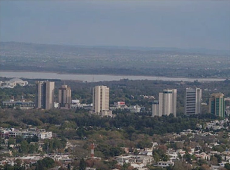
estled in the Margalla Hills, the Islamabad of the 1960s has grown into a sprawling metropolis that has expanded over 500 per cent to accommodate a booming population. Rapid urbanisation has transformed the city into a sweltering hotspot facing severe impacts of climate change.
Islamabad’s population has ballooned from 0.117 million in 1961 to 2.4 million in 2023. The built-up area in the city has increased by 523 per cent, since the 1960s when it was only 10.4 km² (4.0 sq mi) and expanded to 375 km² (116.4 sq mi). It continues to grow rapidly.
Climate change impact
The Margalla Hills, a vital ecosystem and natural buffer against climate change underwent major environmental destruction from the early 2000s with massive deforestation and fragmentation to accommodate the ever-growing population.
Among other real estate projects, Margalla Highway and Islamabad Metro Bus Project fragmented the hills and disrupted the ecosystem causing landslides and rising temperatures.
This also led to a myriad of environmental and urban issues such as longer summers, changes in rainfall patterns causing water scarcity, increased frequency of heatwaves and reduced air quality.
Deforestation and urbanisation lead to a rise in temperatures. According to a study by the Pakistan Council of Research in Water Resources, the urban sprawl has caused the average temperature in Islamabad to rise by 2.5°C (4.5°F) over the past three decades, with a significant increase in heatwaves and other extreme weather events.
Changing seasons
Mahr Sahibzad Khan, the director general of Pakistan Meteorological Department, says the temperature regime has been disturbed.
“The night temperatures have risen alarmingly. According to PMD calculations, the average maximum temperatures from 1960-1990 was 34.7 °C. It rose by 0.3 °C to 35.0 °C during 1990-2020. Compared to that, the night temperatures have increased by 1.3 °C from 19.5 °C in 1960-1990 to 20.8 °C in 1990-2020. This shift coincides with aggressive urbanisation,” he says.
“Islamabad’s climate has drastically changed over the past three decades,” says Khan. “Until 1990s, compared to the searing temperatures of the southern half of the country, people in Islamabad would continue to enjoy a balmy spring, with cool evenings, by late May which would usher in a kaleidoscope of colours with abundant flowers and foliage leaving a distinct aroma in the air. This would roll out summers that would span from June to August. This has now changed,” he says.
According to the chief meteorologist, summers now last five months (May-September), with average maximum temperatures in June rising from 37.4°C in 1990 to 40.4°C in 2020. Heatwaves have become more frequent, with an average of 5 events per year in the 2010s compared to 3 per year in the 1990s. Temperatures have also risen by 2-3°C over the past 30 years,
Winter months have shifted from December-February to November-January, with the average minimum temperature in January dropping from 2.4°C in 1990 to 0.8°C in 2020. Spring has been squeezed from March-May to February-April. The annual rainfall has decreased by 15 per cent over the past 30 years, with 20 per cent fewer rainy days. Flash flooding events have increased, averaging three events per year in the 2010s compared to one in a year in the 1990s.
Hot and cold
The rapid expansion of maze-like built-up areas in Islamabad has led to an increase in impervious surfaces, trapping heat and reducing airflow. Lacking adequate tree cover to modify the heat, the sweltering, high density, tall buildings and stifling narrow streets create urban canyons, exacerbating the urban heat island effect. As a result, one cannot miss experiencing the distinct “hot and cold zones” while heading from one end of the city to another.
The dense residential localities of DHA, Bahria Town, Sectors D-12, E-11, F-7, F-10, G-9, G-10, G-13 and other upscale neighbourhoods constitute the ‘hotspots.’ These areas have experienced an average temperature increase of 2-3°C (3.6-5.4°F) compared to the surrounding rural areas.
The overcrowded commercial areas like Blue Area, Jinnah Avenue, ( F-8& G-8) and industrial zones (I-8, I-9, I-10) experience ‘oppressive’ temperatures of 3-4°C and 4-5°C higher, respectively. The winding Islamabad Highway, Kashmir Highway and Grand Trunk Road are the other hotspots with an average temperature increase of 2-3°C (3.6-5.4°F).
Areas that have survived deforestation or enclose parks, green spaces and lakes are the ‘cold zones.’ Fatima Jinnah Park, Margalla Hills National Park record an average temperature 2-3°C (3.6-5.4°F) lower than the surrounding areas.
Rawal Lake, Saidpur Lake and some other water bodies are part of the cooler spots with an average temperature decrease of 1-2°C (1.8-3.6°F) compared to the surrounding urban areas.
Encroachment and pollution of water bodies
With the ecological balance severely distorted, the reduced rainfall has led to water scarcity in Islamabad. That has not prevented the encroachment and pollution of River Korang, Rawal and Khanpur lakes and the Simly Dam. Over the years, the area of these water bodies has decreased from 7.09 square kilometers to 6.38 square kilometers to make way for real estate or commercial projects.
Encroachments on River Korang bed started in 2005 with the construction of a few buildings. Those multiplied eventually, reducing the river’s width to 100 feet by 2015. The same happened with Rawal Lake in 2008. This went on unchecked and has polluted the lake’s water beyond any remedy. The pristine Khanpur Lake too suffered a similar fate when buildings were constructed around it in 2010. Within five years, their effluent and waste had polluted the water. Encroachments on the Simly Dam led to severe pollution of the water source.
The city is expanding towards Fateh Jang on one hand while on the other it has almost reached Chakri. Some urban planners say the solution to the unsustainable urbanisation is to stop the horizontal expansion of Islamabad and go vertical.
The government is considering policies to build vertical cities, which are more sustainable and have a smaller carbon footprint. The previous government’s Naya Pakistan Housing Programme did not address the challenges like transportation. Building smart cities like Singapore and Abu Dhabi sounds great on paper but we need to figure out how to design and connect these vertical spaces safely.
Deforestation and wildfire
Islamabad lost an average of 41,100 hectares of forest per year between 1990 and 2000. By 2020, the green area had decreased from 656 square kilometres in 2000 to 420 square kilometres.
One reason for that is deforestation. Another is wildfires. According to the 2022 report by the Islamabad Wildlife Management Board most of the wildfires are the outcome of human activities, including arson, negligence and illegal land clearing.
Alarmingly, the Capital Development Authority has inadequate fire detection and monitoring systems, insufficient firebreaks and access roads in forest areas.
Irfan Niazi, the CDA director-general, says that the early June wildfire was caused by “negligence and mischief.”
Regarding the deployment of the firefighting system, the CDA DG said “it is difficult to transport heavy machinery or trucks to mountainous terrains where fires often erupt. We transport firefighters in vehicles but then they have to walk miles to reach the fire site,” Niazi says. “We use conventional techniques like beating bushes and cutting them to douse the fire.”
Rapid urbanisation raises grave concerns. It perpetuates environmental degradation and spurs climate change. Policymakers and urban planners must prioritise stringent land use regulations while promoting the integration of smart city concept and green infrastructure solutions to mitigate the effects of climate change.
The contributor works for The News International