Workshop at University of Haripur: GIS potential in agriculture, natural resource management underlined
HARIPUR: The Geographical Information System GIS has a great potential in agriculture and natural resource management together with career development of researchers opting to use the modern technique in their project drawing and design.
This was the main focus of the speeches that the scientists gave during the inaugural session of two days international workshop on “Use of GIS Technology and Stable Isotopes for sustainable development in Agriculture and environment”. The Departments of Soil and Climate Sciences University of Haripur had organized the event in collaboration with Pakistan Science Foundation and Chemistry Department of varsity here on Thursday.
The scientists, researchers, academia and students from different parts of the country were in attendance on this occasion. The speakers said that the GIS was a computer based system for collecting, checking, integrating and analyzing information related to the surface of the earth. Highlighting the major applications of GIS, the speakers said that the GIS techniques were being used globally in natural resource and environmental protection. They said socio-economic development, land & water management, civic supplies and crime detection and the developing agro-based economy of Pakistan ought to benefit from the modern techniques for the desired results of prosperity.
They said that GIS has an important role to play in farm management, pest/disease tracking, crop monitoring, yield production and soil analysis. While in environmental sciences it has a very vital role for analysis and formulating the quick mitigation plan for high risk environments, they said. The speakers said it could serve as the ultimate communication of environmental information to the public and policy makers for wildland analysis, hazards mitigation & future planning, air pollution and control, disaster management, oil spills and remedial actions and coal mine fires. They said the GIS could also be used for business purposes, geology, archaeology and architecture purposes and its applications have multidimensional benefits for the researchers, policymakers and the public at large. Dr Arshad Ashraf principal scientist Climate Change, Alternative Energy and Water Resource Institute Islamabad, Dr Sarfraz Ahmed, Dr Imran Shahzad Department of Metrology COMSATS, Dr Rasheed Ahmed, Prof Dr Anwarul Hasan, VC UoH, Dr Ali Raza Gurmani, Chairman, Department of Soil & Climate Sciences, were prominent among those who spoke to the participants on this occasion.


-
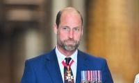 Prince William On Verge Of Breakdown Because Of 'disgraced' Andrew
 -
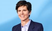 Tig Notaro Reflects On Oscar Nod For 'Come See Me In The Good Light': 'I Was Sleeping'
 -
 Kenyon Sadiq Sets 40-yard Dash Record At NFL Scouting Combine, Eyes First Round
 -
 Talk Show Host Drops Hint About Taylor Swift, Travis Kelce Wedding Date
 -
 Andrew Scandal Brings New Worries For Prince Harry, Meghan Markle
 -
 King Charles Imposes New Restrictions On Ex-Prince Andrew In Surprise Move
 -
 Chris Hemsworth Reveals How Elsa Pataky Guides His Career Moves
 -
 Was Travis Barker In A Relationship With Kim Kardashian Before Marrying Her Sister?
 -
 Brad Pitt Feeling Down In The Dumps After Kids' Snubs As Pals Continue To Paint Angelina Jolie A Villain
 -
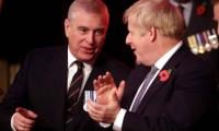 Ex-PM Speaks Out On Andrew Mountbatten-Windsor In Newspaper Column
 -
 Eric Dane Remembered In Glowing Tribute By Trans Activist In 'Grey's Anatomy'
 -
 Zach Braff, Sarah Chalke Explain J.D. And Elliot Twist In 'Scrubs' Revival
 -
 Jim Carrey's Death To Body Double: Comedian's Latest Appearance Sparks Conspiracy Theories
 -
 Aespa's Ningning Steals Spotlight With Hilarious Viral Video From Milan Fashion Week
 -
 Should Benedict Be Forgiven For Mistress Question? 'Bridgerton' Star Yerin Ha Reveals
 -
 John F. Kennedy Jr. Wife Carolyn Bessette's Last Minute Bridal Crisis Revealed