Karachi: PMD sorry for wrong data, says earthquake intensity was 4.5, not 3.6
PMD says Karachi earthquake intensity was measured 4.5 on Richter scale — not 3.6 — as it reported earlier

KARACHI: The Pakistan Meteorological Department (PMD) said it had mistakenly issued the wrong data earlier on an earthquake near the port city, saying its intensity was measured 4.5 on the Richter scale — and not 3.6 — as previously reported.
Citing a data-input error, the PMD issued an apology and said the mistake occurred when information on the Karachi earthquake was entered in Islamabad, leading to the mistake being eventually relayed back to Karachi.
It clarified that the quake struck 60km from Gadani at a depth of 10km. The intensity was initially erroneously reported to be 3.6 on the Richter scale and incorrectly said to have occurred 100 km southeast of Karachi.
According to the United States Geological Survey (USGS), the exact location of the earthquake's epicentre was 25.129°N 66.595°E, 13km west of Gadani. The USGS, however, stood by its data.
The body-wave magnitude was recorded at 4.5 Mb, it added, underlining that the earthquake hit in 50 phases.
Earlier, the PMD had reported that the tremors of the Karachi earthquake were felt at 6:17am and that the depth of the quake's epicentre was 10km underground.


-
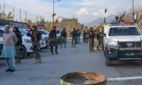 Security forces gun down 30 terrorists in multiple IBOs in KP: ISPR
 -
 MQM-P calls for new province in Sindh
 -
 US report validates Pakistan military edge over India: PM
 -
 Banned TTP poses serious threat to Pakistan security: UNSC panel
 -
 CM Afridi clarifies remarks on by-poll after ECP requests army deployment
 -
 Dubai sees 3.2m Pakistani passengers in 2025 as airport sets new milestone
 -
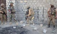 Security forces kill 23 Indian proxy terrorists in KP's Kurram
 -
 Pakistan to construct island to boost oil exploration: report