Cyclone Biparjoy: Keti Bandar needs to be evacuated, Karachi not in danger
For coastal areas like Keti Bandar evacuations are not optional, says climate minister Sherry Rehman
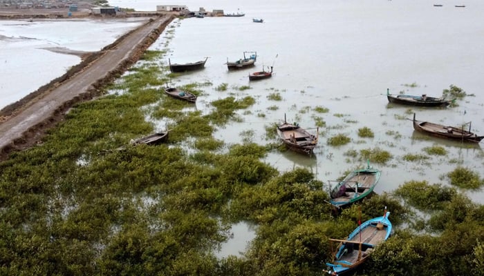
Minister of Climate Change Sherry Rehman said Tuesday that while the very severe cyclonic system (VSCS) Biparjoy will not directly hit Karachi, it will certainly hit Keti Bandar in the Thatta district.
Karachi will likely receive 110mm of rainfall. In contrast, Thatta, Badin, and Sajawal are expected to receive 330mm of rain, the senator, during Geo News' talk show 'Aj Shahzeb Khanzada Ke Saath'.
She further added: "We have a red alert [in place] till June 18 and will issue a new advisory at 11 or 12 o'clock on the day [the storm is expected to make a landfall]."
In a tweet separately, she said: "Panic is understandable, human nature; but it’s important to move with caution & calm."
"Evacuations are painful, stressful and hard to embark on but we must insist on them in areas where see #CycloneBiparjoy making landfall. For Coastal areas like Keti bandar evacuations are not optional."
During the same show, Pakistan Meteorologist Department (PMD) Sindh Chief Meteorologist Sardar Sarfaraz said the storm's intensity had decreased somewhat.
"There is no dangerous situation in Karachi, the cyclone will exit from the city's south," he said.
He, moreover, added that the storm was heading toward the north.
"It will then move north-east, where it will hit or pass Keti Bandar and Indian Gujarat," he said, commenting on the cyclone's trajectory.
The chief meteorologist also shared that there is a possibility of light to moderate rainfall in Karachi today; however, the city will probably receive heavy rainfall on Thursday and Friday.
Latest update on Biparjoy
In its latest update, the Pakistan Meteorological Department (PMD) said that cyclone Biparjoy over northeast Arabian Sea has moved nearly northeastward during last six hours and now lies near latitude 22.1°N and longitude 66.9°E at a distance of about 310km south of Karachi, 300km south-southwest Thatta and 240km south-southwest of Keti Bandar.
The cyclone was previously 370km south of Karachi.
“Maximum sustained surface winds are 150-160 Km/hour gusts 180 Km/hour around the system center and sea conditions being phenomenal around the system center with maximum wave height 30 feet,” it added.
The PDM said favourable environmental conditions (sea surface temperature of 29-30°C, low vertical wind shear and upper-level divergence) are in support to sustain the cyclone strength through the forecast period.
Under the existing upper-level steering winds, the cyclone is likely keep tracking Northeastward and cross between Keti Bandar (southeast Sindh) and Indian Gujarat coast on June 15 (Thursday) evening with packing winds of 100-120km per hour and gusting 140km per hour. "[The] PMD’s cyclone warning centre, Karachi is continuously monitoring the system and will issue update accordingly," it added.


-
 Security forces gun down 30 terrorists in multiple IBOs in KP: ISPR
 -
 MQM-P calls for new province in Sindh
 -
 US report validates Pakistan military edge over India: PM
 -
 Banned TTP poses serious threat to Pakistan security: UNSC panel
 -
 CM Afridi clarifies remarks on by-poll after ECP requests army deployment
 -
 Dubai sees 3.2m Pakistani passengers in 2025 as airport sets new milestone
 -
 Security forces kill 23 Indian proxy terrorists in KP's Kurram
 -
 Pakistan to construct island to boost oil exploration: report