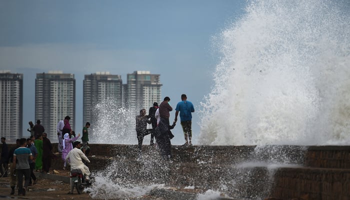
High tides pose no risk to Karachi's DHA: chief meteorologist
"The cyclone will hit on June 15," says Sardar Sarfaraz
KARACHI: Sindh Chief Meteorologist Sardar Sarfaraz Wednesday said the Defence Housing Authority (DHA) in the port city does not face imminent danger from the high tides caused by cyclone Biparjoy nearing Sindh's coastal areas.
According to the latest Met Office advisory, the cyclone originated in the Arabian Sea and is currently positioned approximately 360 kilometers south of Karachi, 355 kilometers south of Thatta and 300 kilometers southwest of Keti Bandar.
From June 14 to 17, the cyclone may bring significant rainfall to Thatta, Sujawal, Badin, Tharparker, Mirpurkhas, Umerkot, and Karachi.
"There are chances of rains on Sindh's coastal belt. The cyclone will hit on June 15, and its effects will remain in place till June 17," Dr Sarfaraz told Geo News.
But, he noted, that smaller settlements near the sea — including Ibrahim Hyderi and Rehri Goth — are still at risk. "The water comes on the roads near Hawkes Bay during the monsoon season as well."
Once the cyclone hits, Sarfaraz said, it will weaken and end in two days.
Biparjoy is currently categorised as a very severe cyclonic storm, down from an extremely severe cyclonic storm.
After the cyclone ends, the chief meteorologist said the weather in Karachi will return to "normal," and sea breeze will blow in the metropolis.
Biparjoy is expected to make landfall around Thursday evening between Mandvi in India's Gujarat and southeast Sindh near Keti Bandar and surrounding areas in Pakistan with a maximum sustained wind speed of 125-135 kilometers (78-84 miles) per hour, gusting to 150 kilometers (93 miles) per hour.
Around 100,000 people are expected to be evacuated today, with almost 20,000 being moved to safer places a day earlier as their areas remain under threat of the cyclone.
-
Security forces gun down 30 terrorists in multiple IBOs in KP: ISPR
-
MQM-P calls for new province in Sindh
-
US report validates Pakistan military edge over India: PM
-
Banned TTP poses serious threat to Pakistan security: UNSC panel
-
CM Afridi clarifies remarks on by-poll after ECP requests army deployment
-
Dubai sees 3.2m Pakistani passengers in 2025 as airport sets new milestone
-
Security forces kill 23 Indian proxy terrorists in KP's Kurram
-
Pakistan to construct island to boost oil exploration: report


