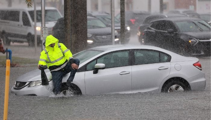
Florida floods: Why is it raining so much in dry season?
In South Florida, recent days have been anything but dry, with some areas experiencing nearly 10 inches of rain since Sunday evening
Although it is still the dry season in South Florida, heavy rain can still happen. The dry season, which lasts from October 15th to May 15th, typically only sees 30% of the yearly rainfall.
However, recent days have been anything but dry, with some areas experiencing nearly 10 inches of rain since Sunday evening.
Why is it raining so much in Florida?
South Florida floods have shocked many. The cause of this rainy weather is a cold front that moved through South Florida on Sunday before stalling across the Florida Straits, as per NBC.
This front has generated lift in the atmosphere and combined with strong high pressure to the north to create a conveyor belt for showers and storms from the Atlantic waters. As a result, many areas in the region have experienced flooding and wind gusts over 40mph.
Tuesday saw a rare combination of advisories, including wind, high surf, small craft, high risk of rip currents, and flood.
This weather pattern is expected to continue for one more day before the front moves back to the north as a warm front on Wednesday night.
Once the trigger is gone and winds shift to the southwest, the weather will quickly dry out and temperatures will warm up. Afternoon temperatures are expected to reach the upper 80s or even close to 90, making people wish for another cold front.
-
Cuban government says boat full of armed men fired on border guards, killing 4
-
FIFA World Cup security concerns spike after recent cartel violence in Mexico
-
Passenger wins £10,000 payout from Heathrow Airport after 100 ml liquids dispute
-
Chinese astronauts finally reveal why spacecraft left them ‘stranded’ for 437 days in space
-
Sinitta makes shock admission about marriage to Andy Willner post Simon Cowell heartbreak
-
Bill Gates calls ties to Jeffrey Epstein 'huge mistake,' reveals past 'affairs'
-
Switzerland announces one-time compensation for Swiss bar fire victims
-
Ryan Coogler shares thoughts about building community of actors amid 'Sinners' success


