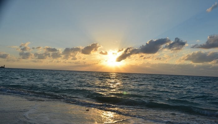
Charting the uncharted waters
About 70% of the earth’s surface is covered with water and ever since the man ventured into the sea, he wished to have the information of depth. Primarily, hydrography is the process of collecting depth data of sea. Measurement / Surveying for this depth data leads to mapping of rivers, lakes and oceans giving information about seafloor which is crucial for safe navigation. Typical final product of a hydrographic survey is a nautical chart / map that reflects depth and other features and information such as rocks, underwater obstructions, wrecks etc. along with necessary publications to support safe navigation.
Hydrography underpins almost every activity associated with the sea including port and harbour construction, resource exploitation (fishing, minerals etc), maritime boundary delimitation between neighbouring countries, laying of seabed pipelines and communication cables, disaster management efforts and coastal zone management etc. Considering the importance of hydrography for every marine related human activity, World Hydrography Day (WHD) is celebrated every year on 21 June to acknowledge and promote hydrographic efforts around the world. Every year a specific theme, related to the contribution of hydrography in world maritime affairs is selected by International Hydrographic Organization (IHO) and this year’s theme is “ Bathymetry – the foundation for sustainable seas, oceans and waterways”.
Early hydrographic surveys were conducted through old traditional methods like pole and rope tied with stone for measuring depths which were laborious, slow and less accurate. However, with the invention of new technologies, the speed of work, quality and coverage of the seabed has been greatly enhanced. Thus modern hydrography has become capable of providing centimetric accuracy in depth and position measurements.
A sea is a common area where mariners from different background and languages of the world navigate for trade, research, defence and other purposes. In this regard, International Hydrographic Organization (IHO) plays an important role in setting up stringent standards for hydrographic surveys. It also coordinates for standardization in nautical charts and other related products.
Pakistan is a coastal state which is blessed with over 1000 Kms of coastline and around 290,000 Sq Kms sea area. The living and non-living resources of this huge area belong to Pakistani nation only. Being a signatory and member of United Nations (UN), International Maritime Organization (IMO) and International Hydrographic Organization (IHO), Pakistan has certain international obligations. As a member and in pursuance of relative resolutions and conventions, Pakistan is obliged to carry out hydrographic surveys and the production of charts/ maps of its waters to provide accurate nautical information to ensure safe passage. This is highly important from Pakistan’s perspective as our trade is heavily dependent on safe seas.
In Pakistan, Pakistan Navy Hydrographic Department (PNHD) fulfils this international obligation. Pakistan’s only Hydrographic / Oceanographic Vessel, BEHR PAIMA, acquired from Japan in 1982 has played a pivotal role in comprehensive survey of the coastal and deep waters of the country. Not only in the field of hydrography, the vessel has a long history for supporting oceanographic scientific research cruises in collaboration with various national academic and research organizations. Owing to extensive requirements, another survey ship is under construction, which will be available by mid of next year. Notwithstanding, the charting centre of PNHD converts the collected hydrographic data into sea maps/charts and produces both traditional paper charts alongwith state of the art electronic charts as per international standards. These electronic charts play central role in today’s e-Navigation concept.
Apart from conducting hydrographic surveys and production of charts, PN Hydrographic Training set up at Karachi trains manpower in this unique field. PN proudly runs IHO accredited hydrographic courses and holds a prominent hydrographic learning place in the region. Officers and men of not only Pakistan but also other friendly countries have been trained by Pakistan Navy.
The Department also represents Pakistan internationally in IHO and Regional Hydrographic Commissions (RHCs). These regional forums promote and coordinate hydrographic activities at regional level. At present, Pakistan is member of two RHCs i.e. NIOHC (North Indian Ocean Hydrographic Commission) and RSAHC (ROPME Sea Area Hydrographic Commission comprising gulf countries). Pakistan is presently Chairman of RSAHC which signifies Pakistan’s initiative and stature in the regional hydrographic activities.
Moreover, to honour international commitment for the safety of mariners at sea, PNHD is also shouldering the responsibility as Coordinator of NAVAREA-IX (A unique position enjoyed by 16 countries of the world) since 1976. Any information which is a safety concern for the vessels transiting in the area are transmitted to give early information to the mariners. This is indeed a great honour for Pakistan which shows the trust of the world community.
There has been a long list of dedicated support extended by PNHD towards national projects. Outcome of these projects is offering handsome share towards national exchequer. Pakistan’s 95% trade is through sea, hence hydrographic surveys of our waters and subsequent mapping has contributed significantly towards safe navigation of merchant ships for trade and naval ships for maritime security operations. Similarly, initial surveys and feasibility studies by the department laid foundation for development of Port Muhammad Bin Qasim, Gwadar, Ormara, Chalna (Bangladesh) etc.
PNHD has played significant role in resolution of maritime boundaries with Iran and Oman. Moreover, a Joint hydrographic survey of Sir Creek by Pakistan and India was also carried out to support resolution of maritime boundary issues. Additionally, PNHD has also played pivotal role alongwith National Institute of Oceanography in securing about 50,000 square kilometers of continental shelf area through a claim at UN.
In short, in last 70 years, despite limited resources and difficult survey environments, Hydrographic setup of PN has indirectly contributed enormously towards national economy, trade, marine research, maritime security, Maritime Boundary resolution with neighbouring countries, generate awareness amongst policy makers and stakeholders in maritime domain e.t.c. Extensive efforts made by Pakistan Navy in the field of Hydrography, provision of resources and assets with national and international outlook speaks of PN resolve and commitment to fulfil international obligations of Pakistan for safe navigation in our waters.


-
 Travis Kelce Plays Key Role In Taylor Swift's 'Opalite' Remix
 -
 How Jennifer Aniston's 57th Birthday Went With Boyfriend Jim Curtis
 -
 JoJo Siwa Shares Inspiring Words With Young Changemakers
 -
 James Van Der Beek Loved Ones Breaks Silence After Fundraiser Hits $2.2M
 -
 Disney’s $336m 'Snow White' Remake Ends With $170m Box Office Loss: Report
 -
 Travis Kelce's Mom Donna Kelce Breaks Silence On His Retirement Plans
 -
 Premiere Date Of 'Spider-Noir' Featuring Nicolas Cage Announced
 -
 Pedro Pascal's Sister Reveals His Reaction To Her 'The Beauty' Role
 -
 Kate Middleton Proves She's True 'children's Princess' With THIS Move
 -
 Paul Anka Reveals How He Raised Son Ethan Differently From His Daughters
 -
 'A Very Special Visitor' Meets Queen Camilla At Clarence House
 -
 Jodie Turner Smith Shares One Strict Rule She Follows As A Mom
 -
 Hailey Bieber Reveals KEY To Balancing Motherhood With Career
 -
 Photo Of Jay-Z, Other Prominent Figures With Jeffrey Epstein Proven To Be Fake
 -
 Hillary Clinton's Munich Train Video Sparks Conspiracy Theories
 -
 Fans Slam Talk Show Host For 'cringe' Behavior In Chris Hemsworth Interview